As we had not travelled into Victoria, so
we decided to do a trip in September 2008, on this trip we did not have our
caravan and we decided to stay in cabins in caravan parks along the way.
We planned where we would like to go,
after years of being very interested in Australian history we decided on the
central area of Victoria as our first trip into this beautiful State.
We travelled the
Hume Highway we have clocked up quite a few kilometers on this highway and find
it a good road to travel.
Our
first stop was at Yass at the Mundoonan rest area for a cuppa, well off the
road, clean and good facilities


One place that
did take our attention as we drove through was Holbrook, which has had a couple
of names before it became Holbrook,


Ten Mile Creek and Germanton .


Ten Mile Creek and Germanton .
The town was named Holbrook in honor of
Lt Norman Douglas Holbrook a decorated wartime submarine captain and driving
through Holbrook you see a submarine, is part of the Otway displayed in
Germanton Park right on the Highway, a great tourist attraction. It is unfortunate this little town will
be bypassed in 2012.
We travelled the Highway to Albury, through Bendigo over to Ballarat where we stayed a couple of nights.
We had pre booked this accommodation and thought we would take something small and less expensive but this was a lesson learnt you get what you pay for, we were disappointed not much room to move and also not thinking about the weather in Victoria it was cold, there was a fan heater but it did not heat up the little cabin very much so we made sure we booked our cabins with more thought to comfort for the remainder of our trip.
Ballarat is a big city, the beautiful architecture of the buildings and this has happened due to the gold rush transforming Ballarat from a sheep station to a major settlement when gold was discovered in 1851. Ballarat is well known for its history, culture and well preserved Victorian era heritage.


This lake has had work done on it since its beginning in 1851 and it looked like it had recently had a face lift, great playground areas for children, paths to walk on, beautiful trees an the most interesting is the wildlife.
The reed bed islands provide sanctuary for a variety of wildlife mostly water birds, Black Swan, Black Ducks, Swamp hens and many more.
Lake Wendouree is one of the few urban lakes in Australia, which is ecologically sound.
Its biological health can be attributed
to the lakeweed, which
reduces the effects of harmful urban sediments flushed into the lake after heavy rain.
The reed beds decrease turbidity thus maintaining areas of clear water
reduces the effects of harmful urban sediments flushed into the lake after heavy rain.
The reed beds decrease turbidity thus maintaining areas of clear water


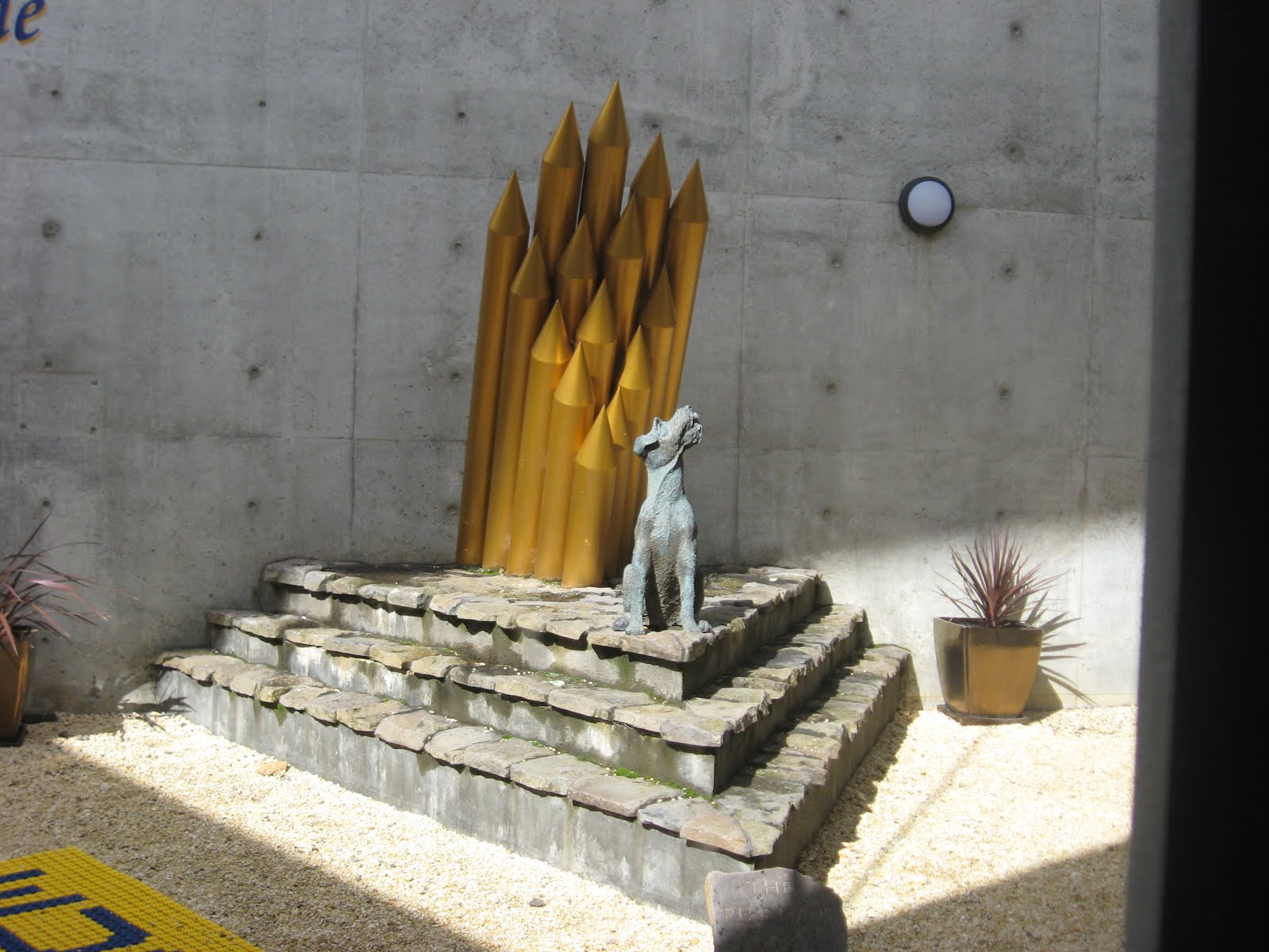


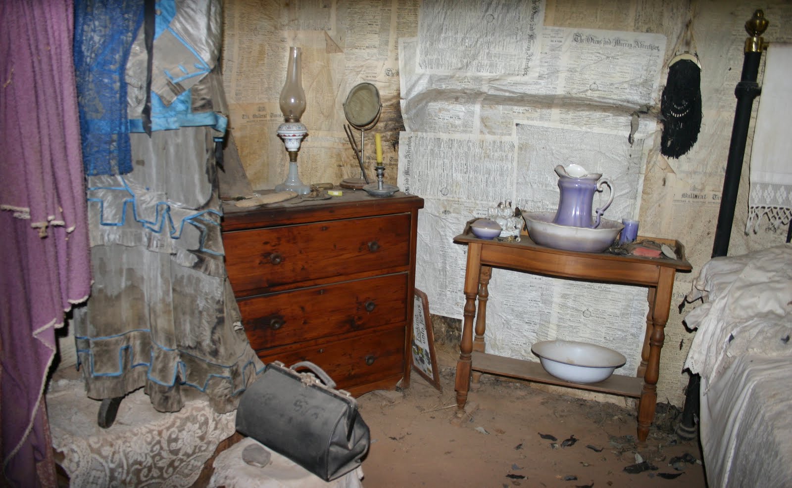
Sovereign Hill is an open air museum at Golden Point on a 25 hectare sit that is linked to the richest alluvial gold rush in the world.
The gold diggings are the centre point of the complex, featuring a winding creek in which visitors are able to pan for real gold.
This area is surrounded by tents and buildings contemporary to the early years of the gold rush.


Two mines which have guided tours, the Red Hill Mine is a self guided tour that tells the story of a ground of Cornishmen and their discovery of the Welcome Nugget.
The Sovereign Quartz Mine runs 40 minute guided tours and features several underground displays. A number of workshops at Sovereign Hill display traditional trades such as coachbuilder, wheelwright, tinsmith, blacksmith and farrier.
The town of
Maldon is located in a histortical gold mining region between Castlemaine and
Bendigo.


Maldon is perfectly
preserved since its mining days and its list of historic buildings is
impressive and includes the railway station - 1884, Grand Hotel – 1888, old Post Office – 1870 and a
number of churches and a streetscape that looks like it hasn’t changed for
well over a hundred years.
Panoramic views of the surrounding region are best seen from the peak of Mount Tarrengower.
Panoramic views of the surrounding region are best seen from the peak of Mount Tarrengower.
Maldon is surrounded by the Maldon
Historic Reserve which contains forests and relics of the district’s gold
mining era.
Castlemaine’s
streetscapes are a reminder of its immensely rich gold mining days with many
public buildings located in Mostyn Street and Lyttleton Street.


The Theatre Royal – 1857 and still used
today, Castlemaine Market – 1862 now the visitor information centre, red-brick
town hall – 1898, courthouse – 1889 as well as several churches and
hotels.
At the eastern
end of Mostyn Street is the towering monument of Burke and Wills erected in
1862 to honour the death of these famous explorers.
In 1860, 25 hectares of gold diggings along Barkers Creek
were set aside for the Castlemaine Botanical Gardens it is recognized as one of
Victoria’s oldest public gardens.
The Castlemaine
Diggings National Heritage Park covers 7,500 hectares and includes relics of
the gold mining era.


which is the northern end of the Great Ocean Road.
A few kilometres south-west of Torquay is Bells Beach


which hosts the Rip Curl Pro Surfing Classic.


which hosts the Rip Curl Pro Surfing Classic.
Torquay is the official start of the Great Ocean Road which covers over 200kms of the south-west Victorian coast, passing through the Otway Ranges, Shipwreck Coast west of Cape Otway.
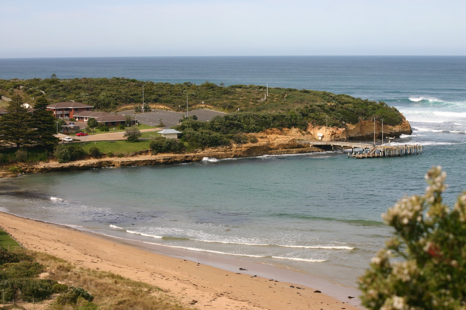
We headed for Lorne which is located between Aireys Inlet and Wye River.


We drove through Aireys Inlet where the Memorial Arch was built to commemorate the construction of the road as a memorial to those who lost their lives during WW1 and Split Point Lighthouse


which was build in 1891 and stands 34 metres tall. Every turn on this road gives you views which are very spectacular. The next little township Wye River a small township with a rugged and bushy mountain backdrop, well noted for its wildlife, beaches and scenery.


which was build in 1891 and stands 34 metres tall. Every turn on this road gives you views which are very spectacular. The next little township Wye River a small township with a rugged and bushy mountain backdrop, well noted for its wildlife, beaches and scenery.
We stayed in a cabin at the Lorne Foreshore Caravan Park


with the Erskine River running alongside and across from the beautiful Lorne beach. As we were not in holiday time we virtually had the park to ourselves and what a beautiful Caravan Park.


with the Erskine River running alongside and across from the beautiful Lorne beach. As we were not in holiday time we virtually had the park to ourselves and what a beautiful Caravan Park.


It was clean, beautiful grounds, wildlife around and the river running alongside the park was just magnificent wish we had more time to stay and enjoy the restful atmosphere.
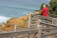
Good views of the area can be seen from Teddys Lookout


and the upper and lower lookouts offer views inland as well as south along the coast.


and the upper and lower lookouts offer views inland as well as south along the coast.
It is not just the beach which is great also the Otway
Ranges in which there are bush walking tracks and the Erskine Falls


are located within the park, 8kms west of the town.
The Great Ocean
Road south of Lorne is a particularly scenic section with the road hugging the
coastline for much of the time, less than 10kms from Lorne is the Mount Defiance
Lookout.
From Lorne we
headed further south-west towards Cape Otway and Apollo Bay.
Memorial Arch the start of The Great Ocean Road


Scenic views can
be seen from Point Sturt at the southern end of the Wye River. The remains of piers built between 1899
and 1910 over the beach and rocks can be observed from here.
A few kilometres south of Wye River is
the community of Kennett River which a little further south is the Cape Patton
Lookout.
Cape Otway is
situated at the southern tip of Victoria’s western coast, where the Southern
Ocean meets Bass Strait. One of
Cape Otway’s most popular attractions is the Cape Otway Lightstation.


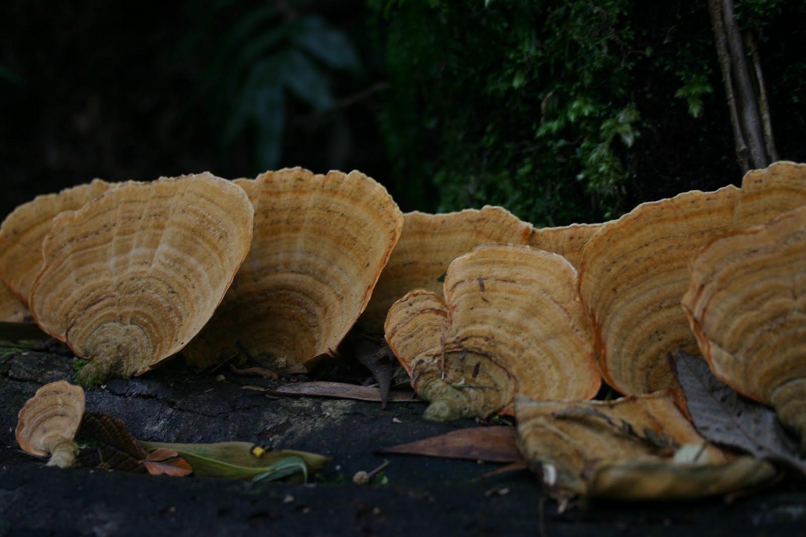
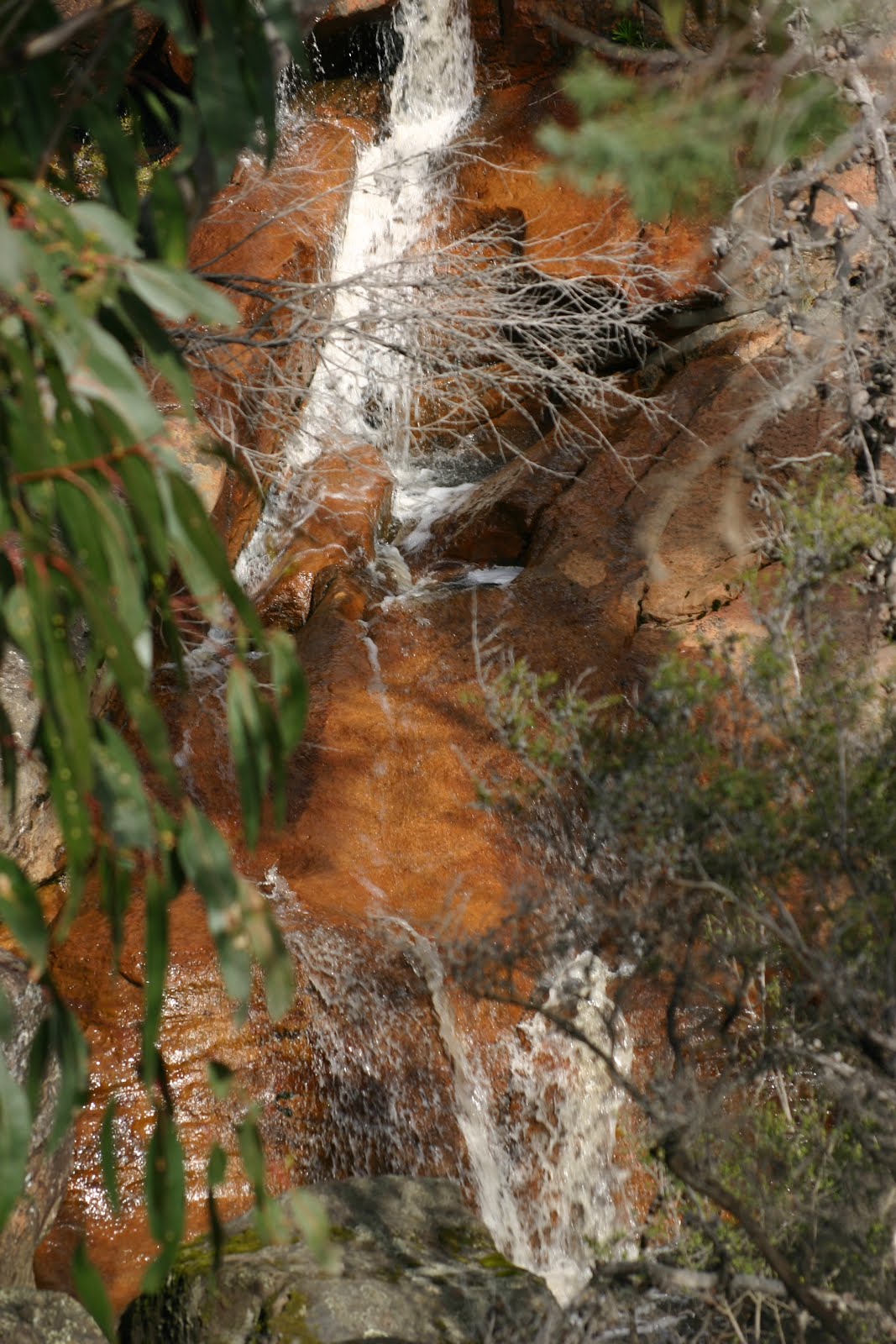
Lavers Hill is situated on the Great Ocean Road north-west of Cape Otway it is in an area of scenic beauty. Perched on the highest point of the Great Ocean Road views can be seen of rolling hills and timbered forests of the Otway Ranges.
Lavers Hill is a handy base for exploring the natural attractions of Triplet Falls, Hopetoun Falls and Beauchamp Falls.
Around a 20 minute drive north east of Lavers Hills is the Otway Fly


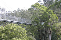


an elevated tree top walk through a beautiful beech myrtle forest featuring a 45metre high lookout tower.


an elevated tree top walk through a beautiful beech myrtle forest featuring a 45metre high lookout tower.
Maits Rest


Apollo Bay has rolling hills which make a scenic backdrop when viewed from the beach also from Marriners Lookout at the northern end of the town. Under certain weather conditions the silhouette of the SS Casino, a steamship which sank in 1932 while trying to dock at Apollo Bay, can be seen in the waters close to shore. There are a couple of museums, The Bass Strait Shell Museum and the Old Cable Station Museum.
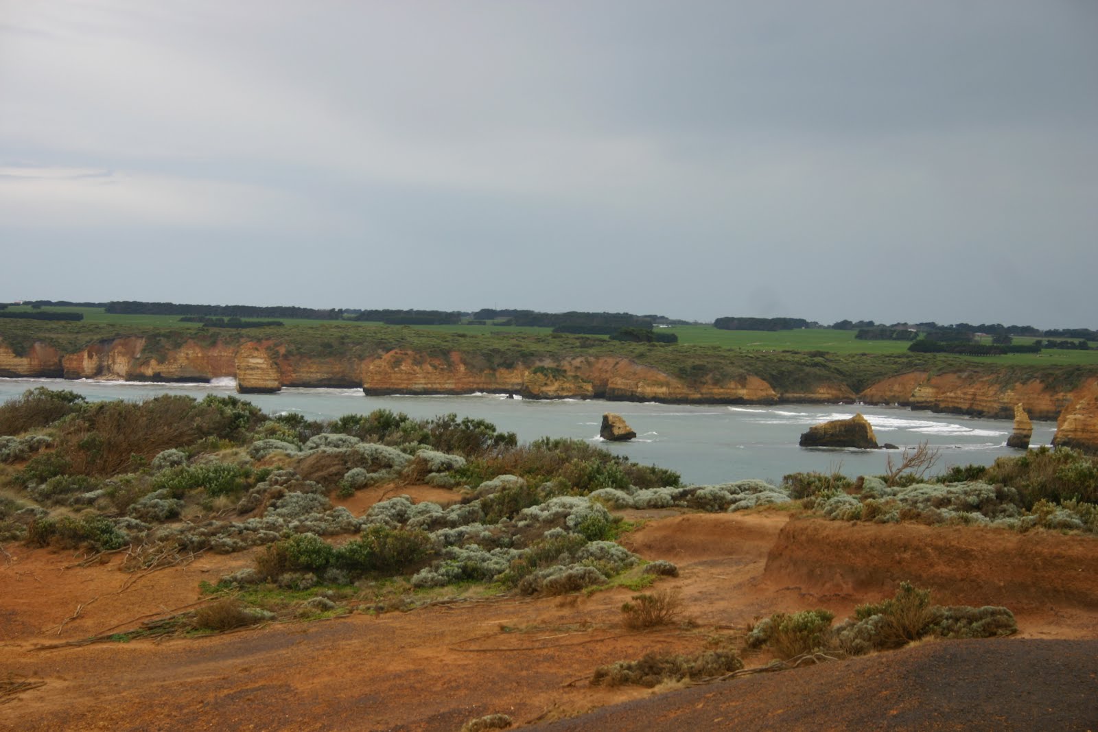
Port Campbell


the most popular tourist destination due to the fact it has the most famous and scenic coastal attractions, London Bridge, which is now broken in the middle, Loch Ard Gorge, Gibsons Steps and of course the Twelve Apostles (8 remaining), which was originally named The Sow & Piglets.
Bay of Islands


Great Ocean Road


On our drive to Halls Gap we stopped at Lake Bellfield to check out the dam, we saw emus and other wild life


we found this to be excellent very central to all our needs, bushwalking, shops within easy drive…………………..Every morning and afternoon we were greeted by the local kangaroos and wallabies grazing around the ground and close to the cabins. Little birds would flit in and out of the trees it was so peaceful.


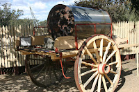
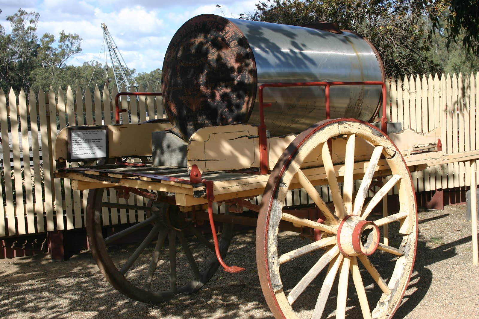
was first established in 1972 then known as the Royal Australian Army Ordnance Corps Centre at Bandiana. The collection quickly outgrew this location and was moved to its present site in 1976. The building is corrugated iron clad and timber framed and was built in 1940. The Royal Australian Army Ordnance Corps Museum was officially opened in 1976. In 1997 the integration of the Army Transport Museum from Puckapunyal, the Army Catering Corps Historical Collection from storage in Bandiana and these all form the Army Museum Bandiana on 1st July 1997.
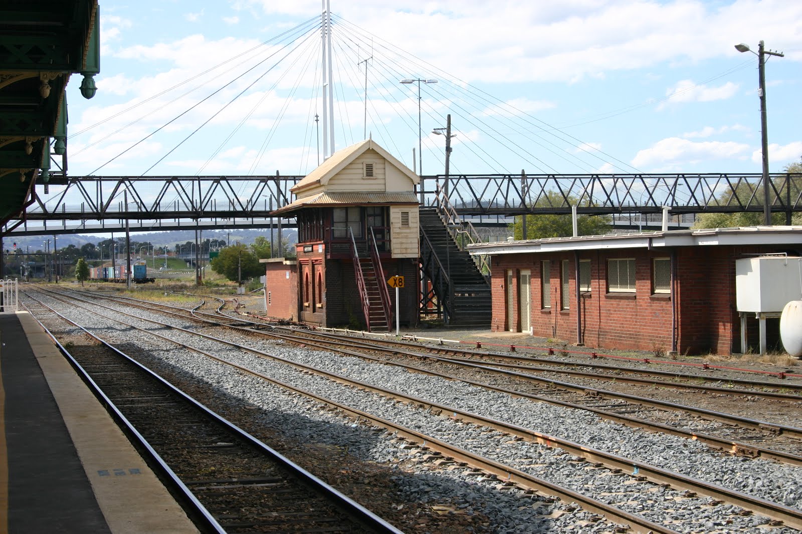
Albury railway station


Waterstreet Hotel where my Uncle Jim lived and i can remember sitting with Jim , mum and dad in the pub listening over and over to Royal Telephone sang by Jimmy Little. That was the first time i had a 50 which is a small glass half filled with beer and the other half with lemonade.


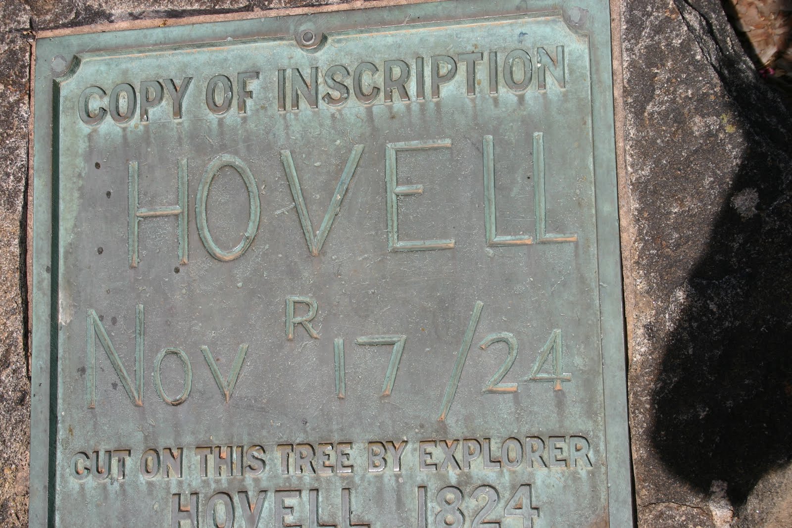
Norouil Park on the Murray river is where my Uncle jim lived in a onsite caravan. I lived visiting him as there was lots of play area. When there one time he entered me in a swimming carnival, i came second. Hume and Hovell explorers tree is here


HOME


Great Ocean Road


On our drive to Halls Gap we stopped at Lake Bellfield to check out the dam, we saw emus and other wild life


Halls Gap


is located in the middle of the Grampians National Park and the town centre is in between the rocky mountain peaks of the Wonderland and Mount William Ranges, the picnic reserve is just across the road from the commercial centre.We stayed at the Halls Gap Caravan and Tourist Park


is located in the middle of the Grampians National Park and the town centre is in between the rocky mountain peaks of the Wonderland and Mount William Ranges, the picnic reserve is just across the road from the commercial centre.We stayed at the Halls Gap Caravan and Tourist Park


we found this to be excellent very central to all our needs, bushwalking, shops within easy drive…………………..Every morning and afternoon we were greeted by the local kangaroos and wallabies grazing around the ground and close to the cabins. Little birds would flit in and out of the trees it was so peaceful.
The Grampians
are one of Victoria’s most impressive natural attractions, bushwalking and
holiday makers love this environment.


The Grampian span the western end of Victoria’s Great Dividing Range and
the National Park covers 167,000 hectares and is home to hundreds of species of
native animal life.


The are some interesting attractions on the road towards
Horsham by taking a detour via Mount Difficult Road to the Boroka Lookout and
along the Mount Victory Road to the Mt Reed Lookout.


The
walking track leads to the falls the top
is Broken Falls then walk down to the base of Mackenzie Falls this can
be a bit slow on the ascend but well worth the walk.
Venus Baths Walk


Our drive from Halls Gap to Swan Hill with lots of Canola fields
.


Venus Baths Walk


Our drive from Halls Gap to Swan Hill with lots of Canola fields
.


In the 1850’s a
wharf on the Murray River was built and Swan Hill became one of the regions
major inland river trading ports.
There is a narrow bridge which crosses the Murray River into New South
Wales built in 1896 and has a central span which can be raised to allow paddle
steamers to pass under.
On our travels
around we see a lot of big things which represent places and Swan Hill has an
11 meter giant replica of a big Murray Cod. The Burkes and Wills is a Moreton Bay fig tree planted in 1860 to commemorate
the expedition as they passed through Swan Hill. It is believed to be the largest of its kind in Australia


When we arrived in Swan Hill we went off to get some groceries and noticed a storm heading towards us but the only thing was it was a funny colour.


We went into Coles and when we came out all the cars around the centre was covered in dust, it was a dust storm and a big one at that.
Echuca


was surveyed in 1854 and quickly became one of Australia’s busiest inland ports with paddle steamers carrying supplies via the interior river network


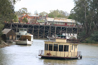


The original red gum wharf was constructed in three stages from 1865 as a three level structure to allow for the rise and fall of the river, reaching a length of 1200 meters, only a small section remains today. Paddle steamer tours are available for overnight stays or just a tour up the river to get the feel, this is a very bit tourism industry today.
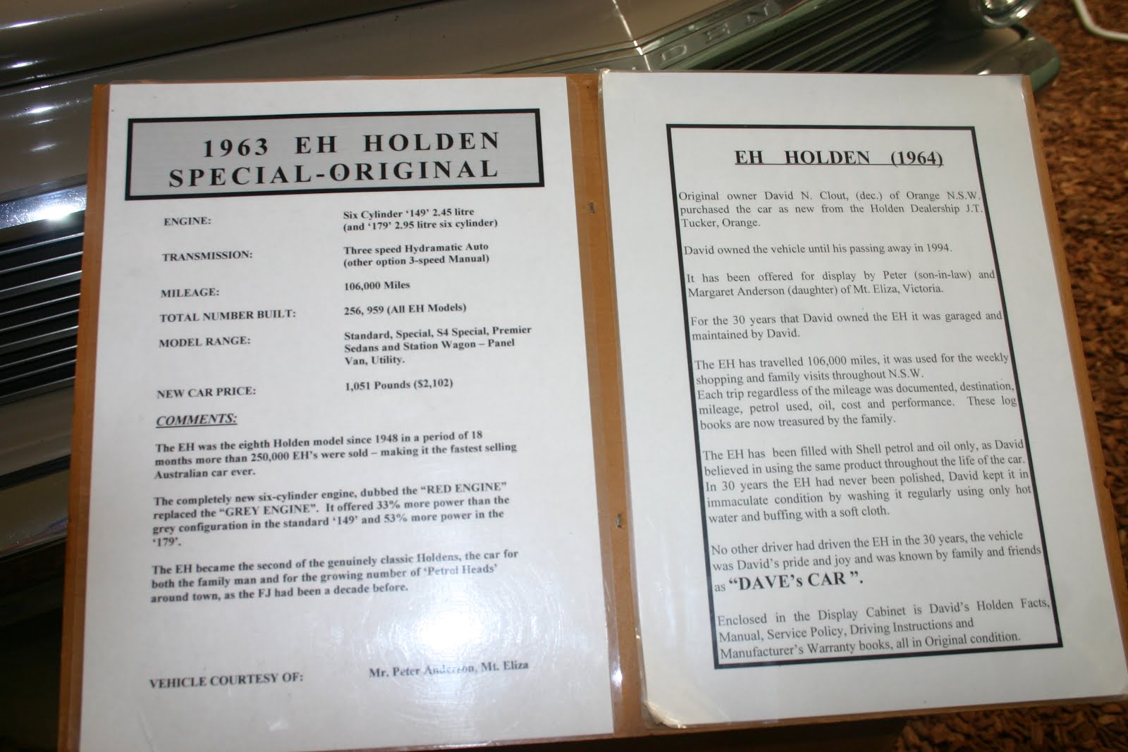
We went for a tour of the Holden museum.


Kingfisher Cruise


Moama


was surveyed in 1854 and quickly became one of Australia’s busiest inland ports with paddle steamers carrying supplies via the interior river network


The original red gum wharf was constructed in three stages from 1865 as a three level structure to allow for the rise and fall of the river, reaching a length of 1200 meters, only a small section remains today. Paddle steamer tours are available for overnight stays or just a tour up the river to get the feel, this is a very bit tourism industry today.
We went for a tour of the Holden museum.


Kingfisher Cruise


Moama


Glenrowan This is a very
small town as we know through Australian history it is known through the famous
bushranger Ned Kelly whose life came to an end in this town. Ned looms large over the town in the
form of a six meter stature in the main street. In 1867 Ned Kelly’s family moved to a wooden hut at Eleven
Mile Creek, not far to the south-west of Glenrowan.


There are no
buildings remaing from Ned Kelly’s lifetime although there is a replica of the
original railway station around the old railway platform and a replica of the
Kelly homestead behind Kate’s cottage and the Kelly museum plus various plaques
around the town depicting the siege.
The Kelly Tree and Stringybark Camping Reserve is
50km from Benalla and 36km from Mansfield with the Toombullup State
Forest. It was here, on the banks
of the Stringybark Creek in 1878 the Kelly Gang members became the most wanted
outlaws in Australia after Police Constables Lonigan, Scanlan and Sargeant
Kennedy were killed. From Benalla
take the


road to Tatong, follow the sign to Tolmie, the is gravel through the State Forest .


road to Tatong, follow the sign to Tolmie, the is gravel through the State Forest .
From Mansfield take
the Mansfield-Whitfield Road for 31km, turn left down the Tatong-Tomie Road and
travel approx 10kms to Stringybark Creek Road. The comprehensive signage at the campground and along the
walking track provides gives historical context to Ned Kelly’s story, his
relationship with the area and events leading up to the pivotal tragedy which
created the Kelly Gang.
The original ARMY MUSEUM BANDIANA


was first established in 1972 then known as the Royal Australian Army Ordnance Corps Centre at Bandiana. The collection quickly outgrew this location and was moved to its present site in 1976. The building is corrugated iron clad and timber framed and was built in 1940. The Royal Australian Army Ordnance Corps Museum was officially opened in 1976. In 1997 the integration of the Army Transport Museum from Puckapunyal, the Army Catering Corps Historical Collection from storage in Bandiana and these all form the Army Museum Bandiana on 1st July 1997.
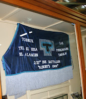
The Museum
houses the following collections:- 2/23rd Australian Infantry
Battalion (Albury’s Own), Australian Women’s Army Service, Australian Service
Nurses, Vietnam Veterans, United Nation and Army Apprentices.
The Museum has
5,000 sq meters of display space under the one roof and has 120 vehicles and motor
cycles, weapons, guns, tanks, audio displays, medals, uniforms and much more.
Our Cabin Park at Albury


Our Cabin Park at Albury


Albury railway station


Waterstreet Hotel where my Uncle Jim lived and i can remember sitting with Jim , mum and dad in the pub listening over and over to Royal Telephone sang by Jimmy Little. That was the first time i had a 50 which is a small glass half filled with beer and the other half with lemonade.


Albury is located on
the Hume Highway and is the second major city of the Riverina region located on
the northern side of the Murray River in New South Wales. It is separated from its twin city,
Wodonga, in Victoria by the Murray River.
Monument Hill


in Albury is the location of the city’s distinctive First World War Memorial and provides a good view of the city. Wonga Wetlands west of the city and adjacent to the Murray River is a key feature of Albury’s use of treated wastewater and consists of a series of lagoons and billabongs, the Wonga Wetlands features more than 150 species of birdlife and a Aquatic Environment Education Centre.
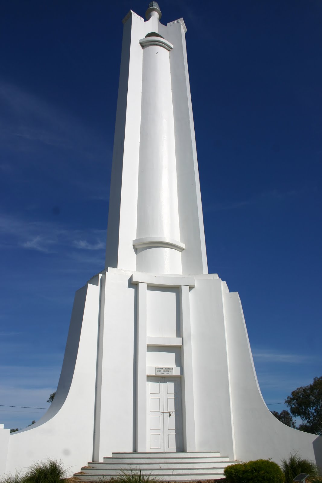


in Albury is the location of the city’s distinctive First World War Memorial and provides a good view of the city. Wonga Wetlands west of the city and adjacent to the Murray River is a key feature of Albury’s use of treated wastewater and consists of a series of lagoons and billabongs, the Wonga Wetlands features more than 150 species of birdlife and a Aquatic Environment Education Centre.
Albury rail
system is on the main Sydney-Melbourne railway line. Originally, New South Wales and Victoria had different
railway gauges, which meant that all travelers in either direction had to
change trains at Albury. To
accommodate this a very long railway platform was needed, 450 meters possibly
the longest in Australia.
The Botanical gardens are a credit to the town with wonderful flowers and trees all around.


The Botanical gardens are a credit to the town with wonderful flowers and trees all around.


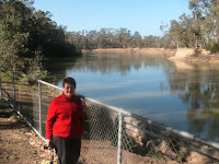
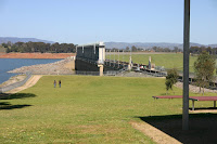
Lake Hume is
situated on the Murray River upstream of Albury The Hume Dam wall took 17 years to construct (1919-1936),
when full the lake covers 80sq kilometers


We visited Aunty Wilma who was my Uncle Allans wife. We also went to my grand parents cemetery plot.


We visited Aunty Wilma who was my Uncle Allans wife. We also went to my grand parents cemetery plot.


Norouil Park on the Murray river is where my Uncle jim lived in a onsite caravan. I lived visiting him as there was lots of play area. When there one time he entered me in a swimming carnival, i came second. Hume and Hovell explorers tree is here


Wodonga is
situated on the southern side of the Murray River. Wodonga was founded in 1852, becoming a important river port
for nearby Victorian goldfields and the first bridge across the Murray was
build in 1860. In 1947 a migrant
camp was established east of Wodonga which was part of the government’s
post-war migration scheme. Wodonga
is separated from Albury by Gateway island which is surrounded by the Murray
River and Wodonga Creek.
Beechworth


is one of Victoria’s best preserved former gold mining towns. The Historical and Cultural Precinct is a major attraction comprising of the towns court house, telegraph station, town hall, a museum and a dark cell which at one time housed the infamous bushranger Ned Kelly. In autumn the trees along the streets have a beautiful colour display.


is one of Victoria’s best preserved former gold mining towns. The Historical and Cultural Precinct is a major attraction comprising of the towns court house, telegraph station, town hall, a museum and a dark cell which at one time housed the infamous bushranger Ned Kelly. In autumn the trees along the streets have a beautiful colour display.
Yackandandah’s


entire commercial centre has been classified by the National Trust and features well preserved buildings which date back to the mid and late 1800’s during the height of the towns gold mining days.


entire commercial centre has been classified by the National Trust and features well preserved buildings which date back to the mid and late 1800’s during the height of the towns gold mining days.
HOME