SNOWY TRIP 5th – 9th APRIL
2007
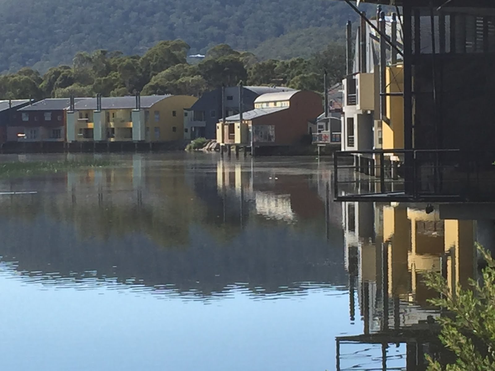
Gil and I decided on a trip around the
Snowy Mountains region and we thought autumn would be the best time. We headed for Gundagai for our first
nights stay, our accommodation was cabins in caravan parks which we prefer to
Motel rooms. The trip down the
Hume Highway was good usual traffic so we arrived in Gundagai four and half
hours, a good run. On the way into
Gundagai we visited the immortal Dog on
the Tuckerbox,


it is a pretty spot with a new garden, a café, with souvenirs and Australiana and old wares and picnic area, the monument is set back from the highway. Gundagai has a lot of history, old buildings,


bridges and the railway station. The Gundagai Railway Station


was built in 1885 and officially opened to passengers in 1886 and further rail lines opened to Cootamundra to Tumut. This line is no longer in service and has been closed due to heavy flooding in January 1984 at Mount Horeb. The Gundagai Railway Station was left to decay due to no maintenance and was to be bulldozed down, the locals got together and have restored this historical station into a wonderful museum, this is a must see place for any visitor to Gundagai we enjoyed walking over the rail tracks, the museum with the ‘conductor’ in uniform pretending to buy our tickets, it was a lot of fun. The Historic Bridges of Gundagai,


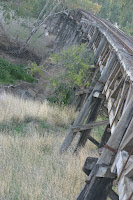


Prince Alfred Bridge built in 1866, Railway Bridge built in 1902 and dual Shehan Bridges are also worth a visit, these old wooden bridges have stood the test of time over the flood plains although they are closed and nobody is allowed to enter onto the bridges they have national significance with listing under the National Trust.
From Gundagai to Thredbo


it is a pretty spot with a new garden, a café, with souvenirs and Australiana and old wares and picnic area, the monument is set back from the highway. Gundagai has a lot of history, old buildings,


bridges and the railway station. The Gundagai Railway Station


was built in 1885 and officially opened to passengers in 1886 and further rail lines opened to Cootamundra to Tumut. This line is no longer in service and has been closed due to heavy flooding in January 1984 at Mount Horeb. The Gundagai Railway Station was left to decay due to no maintenance and was to be bulldozed down, the locals got together and have restored this historical station into a wonderful museum, this is a must see place for any visitor to Gundagai we enjoyed walking over the rail tracks, the museum with the ‘conductor’ in uniform pretending to buy our tickets, it was a lot of fun. The Historic Bridges of Gundagai,


Prince Alfred Bridge built in 1866, Railway Bridge built in 1902 and dual Shehan Bridges are also worth a visit, these old wooden bridges have stood the test of time over the flood plains although they are closed and nobody is allowed to enter onto the bridges they have national significance with listing under the National Trust.
From Gundagai to Thredbo


From Gundagai we travelled into the
Kosciuszko National Park, through Batlow


famous for apples and beautiful grazing country, we noticed a few road side stalls which gives this little town a real country feel. We made our way to Adelong, and this place has some significance for us as my maternal grandmother grew up in Adelong and I had never been here before it is a historic, country town with quaint farm houses and buildings. Adelong was once a gold mining town from 1840’s to the 1940’s. On our way to Kosciuszko National Park


we could see there had been fires through the bush along the roadway and not all that long before we arrived, although it looked desolate in parts with the black trunks of the trees and bare earth, the signs of re-growth was starting and the new green shoots gave a beautiful contrast.


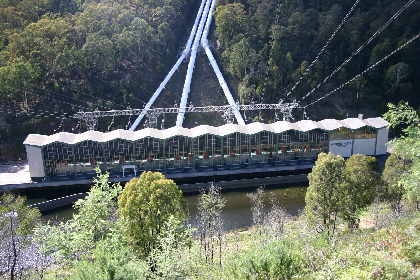
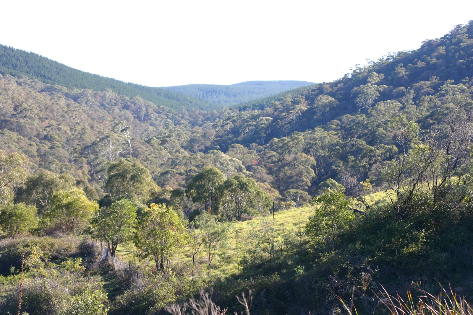
This was a great time of the year to be driving in this part of New South Wales, although a little cool it was very pleasant. The National Park covers almost 700,000 hectares and is Australia’s most extensive alpine area, our aim is to walk some of the way to Mt Kosciuszko itself so we are heading to Threadbo. We made a quick stop at the Snowy Mountains Scheme which is one of the most complex hydro-electric schemes in the world with only two percent of the entire construction visible above ground it started in 1949 and was finally completed in 1974. The entire scheme covers a mountainous area of approx 5,124 sq kms and is by far the largest engineering project ever undertaken in Australia, it consists of sixteen major dams, seven power stations, a pumping station and 225 kms of tunnels, pipelines, and aqueducts. Thredbo


is a great place it is open all year round, winter is the snow/skiing season and summer/autumn the walking season, we parked the car put on our all weather coats and walked up to the chair lift our first step to seeing Mt Kosciuszko. This was great, we were very excited, the chair lift ride was smooth getting on and off and of course there is a coffee shop at the end to warm you up, the air was very fresh and chilly.


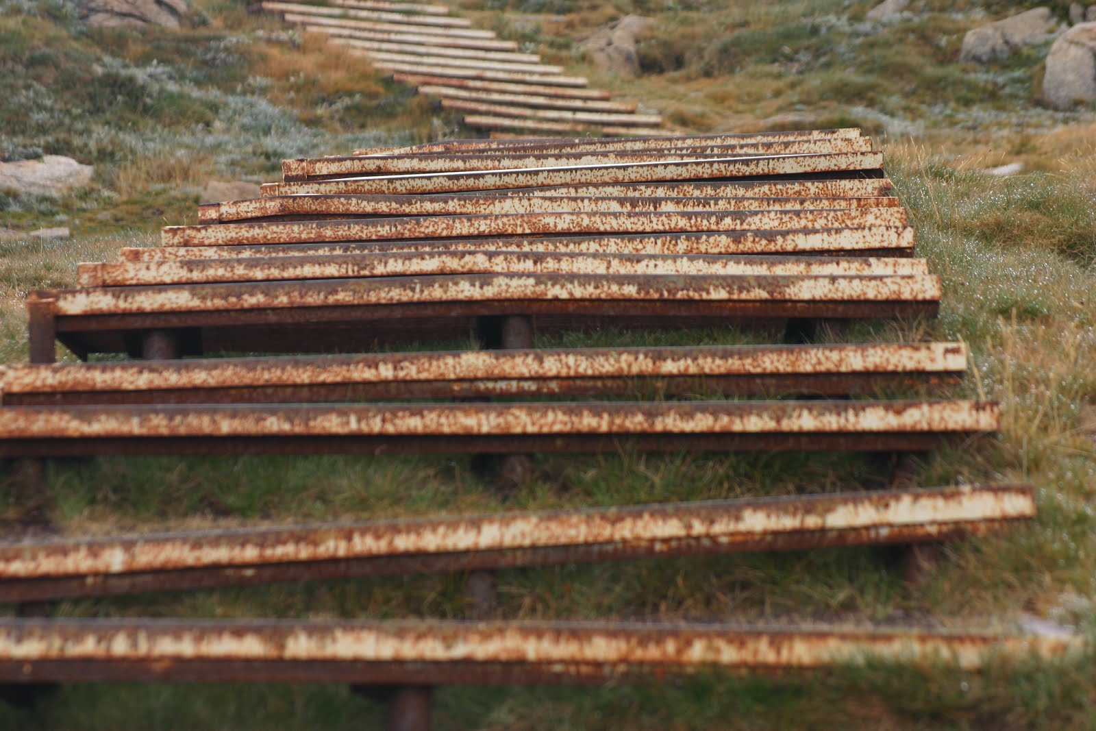
There is a clear walking trail and also parts have board walks that are great as this keeps walkers from trudging everywhere and destroying the alpine plants that are very beautiful and protected, some of them are so small.


We walked a couple of kms but the weather started to get worse so we decided to return we enjoyed this very much, it is beautiful, the scenery is fabulous, we will return again. We left Thredbo and headed for Jindabyne, driving through the Great Dividing Range through Dead Horse Gap,


this is a watershed of 1580 metres between the Thredbo Snowy system and the Murray River. This is so named as brumbies (wild horses) have become trapped in this area during unexpected snowfalls and died. There are some magnificent views from this area.


famous for apples and beautiful grazing country, we noticed a few road side stalls which gives this little town a real country feel. We made our way to Adelong, and this place has some significance for us as my maternal grandmother grew up in Adelong and I had never been here before it is a historic, country town with quaint farm houses and buildings. Adelong was once a gold mining town from 1840’s to the 1940’s. On our way to Kosciuszko National Park


we could see there had been fires through the bush along the roadway and not all that long before we arrived, although it looked desolate in parts with the black trunks of the trees and bare earth, the signs of re-growth was starting and the new green shoots gave a beautiful contrast.


This was a great time of the year to be driving in this part of New South Wales, although a little cool it was very pleasant. The National Park covers almost 700,000 hectares and is Australia’s most extensive alpine area, our aim is to walk some of the way to Mt Kosciuszko itself so we are heading to Threadbo. We made a quick stop at the Snowy Mountains Scheme which is one of the most complex hydro-electric schemes in the world with only two percent of the entire construction visible above ground it started in 1949 and was finally completed in 1974. The entire scheme covers a mountainous area of approx 5,124 sq kms and is by far the largest engineering project ever undertaken in Australia, it consists of sixteen major dams, seven power stations, a pumping station and 225 kms of tunnels, pipelines, and aqueducts. Thredbo


is a great place it is open all year round, winter is the snow/skiing season and summer/autumn the walking season, we parked the car put on our all weather coats and walked up to the chair lift our first step to seeing Mt Kosciuszko. This was great, we were very excited, the chair lift ride was smooth getting on and off and of course there is a coffee shop at the end to warm you up, the air was very fresh and chilly.


There is a clear walking trail and also parts have board walks that are great as this keeps walkers from trudging everywhere and destroying the alpine plants that are very beautiful and protected, some of them are so small.


We walked a couple of kms but the weather started to get worse so we decided to return we enjoyed this very much, it is beautiful, the scenery is fabulous, we will return again. We left Thredbo and headed for Jindabyne, driving through the Great Dividing Range through Dead Horse Gap,


this is a watershed of 1580 metres between the Thredbo Snowy system and the Murray River. This is so named as brumbies (wild horses) have become trapped in this area during unexpected snowfalls and died. There are some magnificent views from this area.
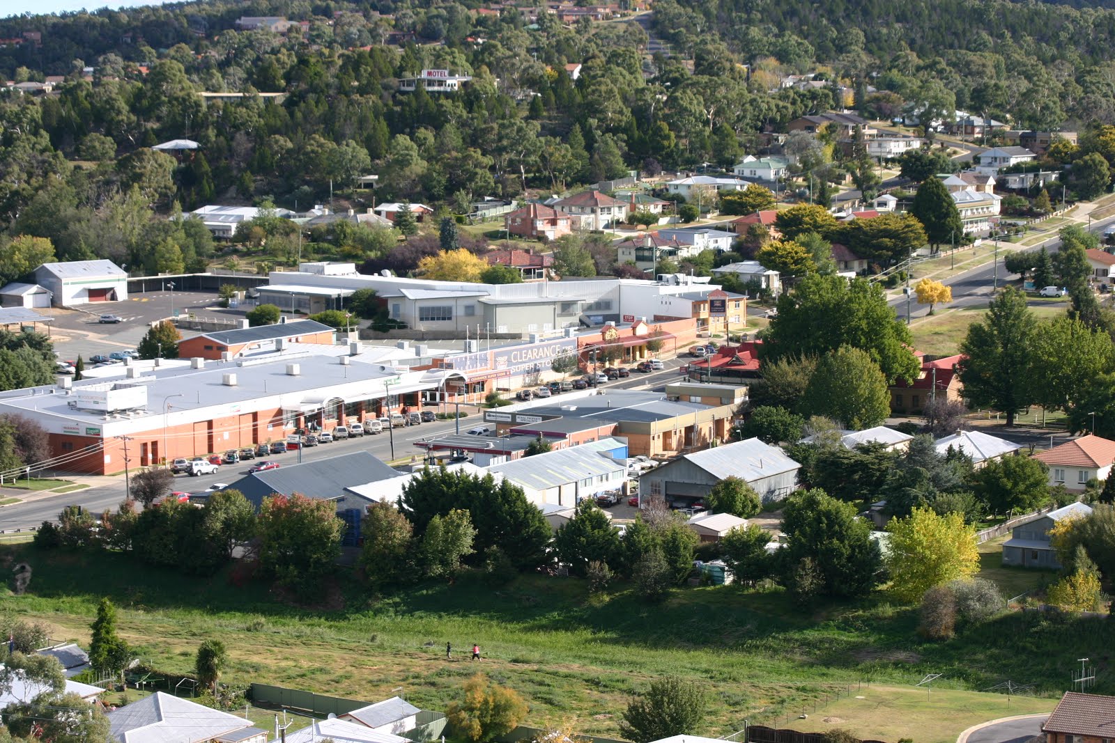
Cooma is the largest town in the Snowy Mountains,


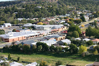


the name Cooma was named after a sheep run in the area. The name John Lambie is significant in Cooma he was a prominent road builder, and Mt Lambie is named after him and he was also appointed the first Commissioner of Crown Lands, today there is a town walk past historic sites and this is called the Lambie Town Walk. Part of the town walk goes up to the historic lookout of Nanny Goat Hill where there is a reserve and a 360 degree view of the township and surrounding country. Dalgety


was a proposed site for the nation’s capital and this is the only town remaining on the Snowy River. Dalgety survived after the Snowy Mountains Scheme was built and the old towns of Jindabyne and Adaminaby


were flooded. The old wooden bridge over the river is just wonderful and a view up the river is tranquil and beautiful. Kiandra is a town that was and has now nothing left. Gold was discovered in 1859 and a town quickly grew but the gold only lasted 100years. Kiandra is best known as the birthplace of Australian snow skiing. The area is rich in pioneer history, with relics such as water races built by the miners and an old cemetery.


There are Heritage walks that take you past some of the significant sites. You can drive through Kiandra quickly and not stop or stop and take in the history of the area, a very pretty place. Jindabyne is a new town created after the original settlement was drowned by the Snowy Mountains Scheme in the 1960’s.


The new town of Jindabyne is situated at the end of Lake Jindabyne and owes its existence to its proximity to the major ski resorts and the great facilities it offers to trout fishermen. Located 61km from Cooma it lies on the snowline but is close enough to be an ideal accommodation spot for people not wanting to stay in the chalets on the snowfileds. The tiny settlement of East Jindabyne has grown up on the far side of the dam and is located directly above the site of the old township. Some of the roads in East Jindabyne still disappear into the lake to continue as underwater roads in Old Jindabyne. Perisher Valley


was used in the pioneering days by the graziers for summer pasture and the name Perisher is believed to have come from the graziers trying to rescue livestock trapped in the high country braving the full force of blizzards stating “This is truly a perisher”. Today along with Smiggin Holes, it is one of New South Wales popular snow skiing areas and other winter sports. Eucumbene Dam


built on the Eucmbene River was completed between 1956 and 1958 and this created the manmade Lake Eucumbene. Lake Ecumbene is one of Australia’s highest water storages and has a unique alpine climate it has been known to snow in summer. This lake is famous for its trout fishing and considered the best in Australia.


On our visit the lake was very low a lot of New South Wales was experiencing bad drought and you could certainly notice this by the lake level. The township of Adaminaby lies beneath Lake Ecuumbene.


the name Cooma was named after a sheep run in the area. The name John Lambie is significant in Cooma he was a prominent road builder, and Mt Lambie is named after him and he was also appointed the first Commissioner of Crown Lands, today there is a town walk past historic sites and this is called the Lambie Town Walk. Part of the town walk goes up to the historic lookout of Nanny Goat Hill where there is a reserve and a 360 degree view of the township and surrounding country. Dalgety


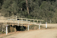
was a proposed site for the nation’s capital and this is the only town remaining on the Snowy River. Dalgety survived after the Snowy Mountains Scheme was built and the old towns of Jindabyne and Adaminaby


were flooded. The old wooden bridge over the river is just wonderful and a view up the river is tranquil and beautiful. Kiandra is a town that was and has now nothing left. Gold was discovered in 1859 and a town quickly grew but the gold only lasted 100years. Kiandra is best known as the birthplace of Australian snow skiing. The area is rich in pioneer history, with relics such as water races built by the miners and an old cemetery.


There are Heritage walks that take you past some of the significant sites. You can drive through Kiandra quickly and not stop or stop and take in the history of the area, a very pretty place. Jindabyne is a new town created after the original settlement was drowned by the Snowy Mountains Scheme in the 1960’s.


The new town of Jindabyne is situated at the end of Lake Jindabyne and owes its existence to its proximity to the major ski resorts and the great facilities it offers to trout fishermen. Located 61km from Cooma it lies on the snowline but is close enough to be an ideal accommodation spot for people not wanting to stay in the chalets on the snowfileds. The tiny settlement of East Jindabyne has grown up on the far side of the dam and is located directly above the site of the old township. Some of the roads in East Jindabyne still disappear into the lake to continue as underwater roads in Old Jindabyne. Perisher Valley


was used in the pioneering days by the graziers for summer pasture and the name Perisher is believed to have come from the graziers trying to rescue livestock trapped in the high country braving the full force of blizzards stating “This is truly a perisher”. Today along with Smiggin Holes, it is one of New South Wales popular snow skiing areas and other winter sports. Eucumbene Dam


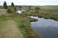
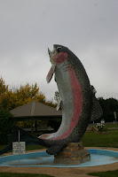
built on the Eucmbene River was completed between 1956 and 1958 and this created the manmade Lake Eucumbene. Lake Ecumbene is one of Australia’s highest water storages and has a unique alpine climate it has been known to snow in summer. This lake is famous for its trout fishing and considered the best in Australia.


On our visit the lake was very low a lot of New South Wales was experiencing bad drought and you could certainly notice this by the lake level. The township of Adaminaby lies beneath Lake Ecuumbene.
Yarrangobilly
Caves are located at the northern end of the
Kosciuszko National Park in the deep gorges of the Yarrangobilly Valley. These limestone caves feature delicate
shawls, grand columns, underground pools and awesome chambers. Yarrangobilly also has a natural
thermal pool that is a constant 27 degrees Celsius.


Four caves are regularly open for viewing -The South Glory Cave for self-guided tours, the Jersey and two others. We would recommend a stop at these beautiful caves, a swim in the thermal pool and a great walk along the walking trail


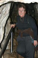


beside the creek and up to the car park very, very pretty place. On our way to Tumut we stopped at Talbingo


this was a very pretty drive into the town past the Jounama Pond a waterway created by the Snowy Mountains Scheme. The old township of Talbingo lies beneath the Jounama Pond, and Talbingo is 42km from Tumut.


Four caves are regularly open for viewing -The South Glory Cave for self-guided tours, the Jersey and two others. We would recommend a stop at these beautiful caves, a swim in the thermal pool and a great walk along the walking trail


beside the creek and up to the car park very, very pretty place. On our way to Tumut we stopped at Talbingo


this was a very pretty drive into the town past the Jounama Pond a waterway created by the Snowy Mountains Scheme. The old township of Talbingo lies beneath the Jounama Pond, and Talbingo is 42km from Tumut.
Tumut


in a lush green valley discovered by Hume & Hovell is built alongside the Tumut River. This town has cafes, eateries and is very pretty it is in the foothills of the Snowy Mountains where you can fish for trout, kayak and walking trails. We have come to the end of our Snowy trip our final journey if through the Brindabella National Park


to go home through Canberra. To start the road is sealed then becomes dirt but good condition the vegetation is pine forests then as we drove further into the park the forest changes to red stringybark and scribbly gum trees it is a favorite spot for 4WD. It was a very beautiful trip through the National Park rather than take the normal highway the road would definitely be better to take in dry weather only.
No comments:
Post a Comment